Well before the creation of Lake Lanier, this was the site of two major episodes of racial cleansing. In the 1830s, the U.S. Government forcibly removed members of the Cherokee Nation from North Georgia along what became known as the Trail of Tears. One of many removal routes terminates at what is now the western bank of Lake Lanier.
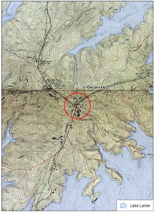
Less than a century later, in 1912, local law enforcement in Forsyth County arrested several Black residents on scant evidence for rape and murder. A white lynch mob murdered one of the men, and two others were convicted and publicly hung. In the following weeks, groups of violent “night riders” drove out the 1,100 Black residents of Forsyth County. These events are often connected to the small crossroads community of Oscarville, where three of the accused lived. Portions of Oscarville and other areas across Forsyth County where Black residents once lived, worked, and farmed are now under the surface of Lake Lanier.
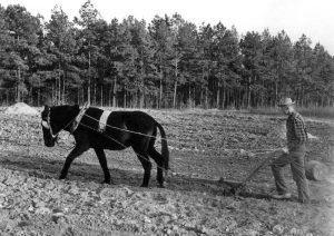
Early Twentieth-Century Farm Life in Hall County, Georgia
Vernon Maddox: “…my wife’s grandmother had to leave from there and they had to leave all that land. And some white people that lived next door to them gave them money because they just had built a garden. They had a beautiful garden and they gave them that money because they waited till midnight to run….. Everybody asleep, they run them out.”
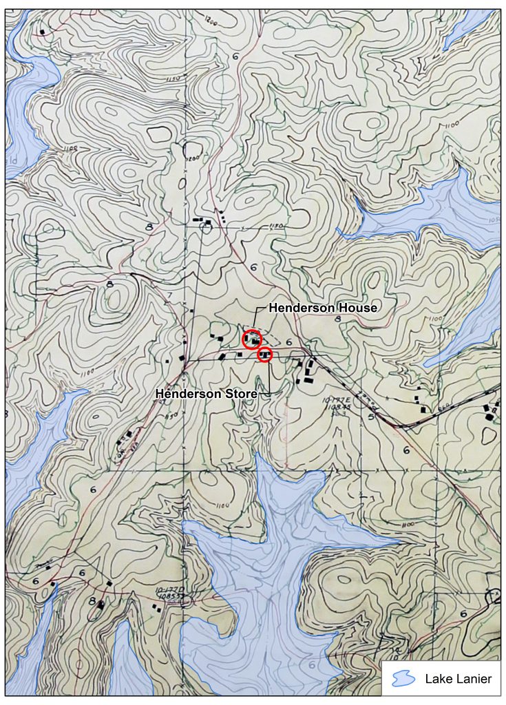
Henderson House and Store (scroll over image to enlarge)
When people reference the troubled history of Lake Lanier, they are usually referring to these incidents.
In the decades before construction on Buford Dam began, the area consisted of small farming communities along the banks of the Chattahoochee River.
Jerry Henderson:“It was just a rural farming area. You know, before Lake Lanier nobody had any money really. My grandfather’s little store, they would barter, and they would bring eggs and butter to the store and trade it for coffee or flour. Not many people around here grew wheat, so you’d barter for that. Even rabbits he would take, he had a little bin in the back of his little store that he built in the ‘30s.”
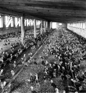
Poultry Farming in Hall County, Georgia, in the 1950s
Alan Wayne: “…back well before the lake, all in that basin the lake was built in, land was so cheap. We’re probably talking 1920, 30. The land was like $2 an acre.”
Cotton and corn were the major cash crops until the early-twentieth century. Cotton production declined in the 1930s due to falling prices and infestations of boll weevil beetles, which fed on the cotton plants. Meanwhile, the flood-prone Chattahoochee River washed over the barren fields and carried topsoil away in its muddy waters.
Wayne Hill:“I could remember when it’d rain in the mountains, we got flooded down here…. the river would get a mile wide before they built the dam.”
Poultry farming took hold in the 1940s. Farmers also began to address the soil erosion. They planted kudzu and fescue to protect the topsoil and used chicken waste manure to enrich the fields.
In the 1950s, the land that would soon be covered by Lake Lanier consisted of scattered farmsteads. Some farmers planted crops, some had transitioned to poultry, and others raised grazing livestock. The woodlands between farms were covered in native oak, hickory, pine, and sweet gum trees. Rural churches, roadside stores, and mills also dotted the landscape. A modest highway network with roads, ferries, and bridges connected people and places.
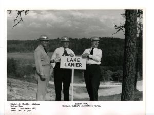
Corps Engineers Survey the Area in 1953
Jerry Henderson:“When it was dry we would take our corn to a local mill. One of those old waterwheel mills on Six Mile Creek now covered by water. It was run by Mr. Millwood, who would grind it into corn meal for our cornbread.”
Prior to Lake Lanier, the culture was more connected to the Appalachian mountains to the north than to urban Atlanta to the south.
Jerry Henderson: “I remember before the lake was built, just in the summertime, it was really lonesome up here….. I’d sit on the porch because I knew what time the mailman came. So that was like the highlight of the day.”
The pace of life was slow. But all of that was about to change.